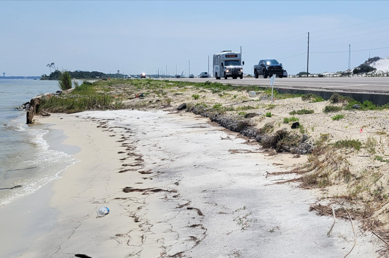
The Okaloosa Board of County Commissioners has approved a Memorandum of Understanding (MOU) to address coastal erosion alongside Highway 98 on Okaloosa Island through a collaborative living shoreline project.
- The project aims to protect the vulnerable stretch of shoreline, support military readiness, and restore coastal habitats.
U.S. Highway 98, a critical east-west corridor in northwest Florida, is the sole vehicle route connecting Fort Walton Beach to Destin along the southernmost portion of Okaloosa County. The 4.5-mile stretch crossing Okaloosa Island serves an average of 43,301 vehicles daily, ranking it among the busiest roads in the county.
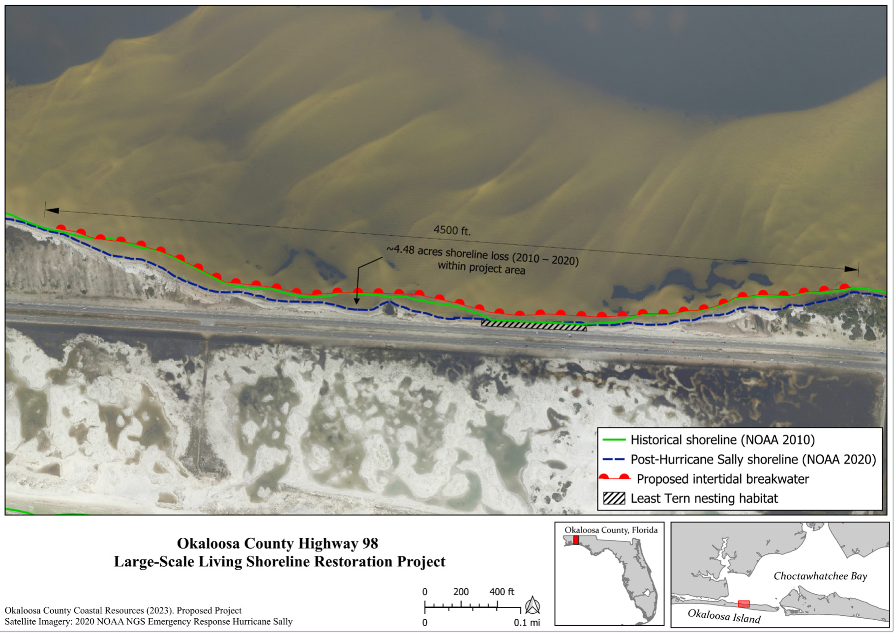
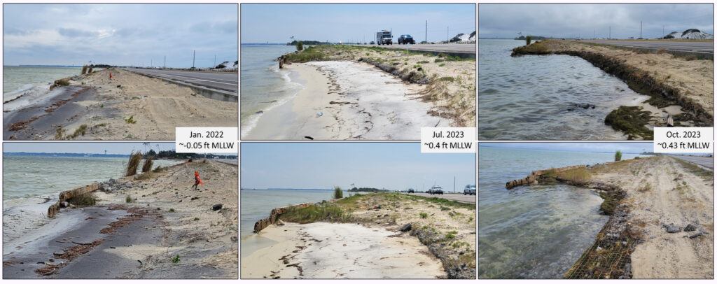
Mike Norberg, Coastal Resource Coordinator for Okaloosa County, explained that the north side of Okaloosa Island faces significant wind and waves from Choctawhatchee Bay, resulting in an estimated 4.48 acres of shoreline erosion since 2010.
- “The living shoreline project is a proactive approach to address the coastal erosion issue while simultaneously providing multiple benefits to the ecosystem, community, and military,” Norberg explained. “By stabilizing the shoreline, we not only help protect the adjacent roadway but also create valuable habitat for a variety of species, enhance coastal resilience, and offer new recreational opportunities for residents and visitors alike.”
The approved MOU recognizes the value of a strategic coalition between Okaloosa County, Eglin Air Force Base, and The Nature Conservancy to address this issue. The collaboration aims to improve community resilience, support military mission readiness, reduce potential impacts to commerce and transportation routes, and restore coastal fish and wildlife habitat.
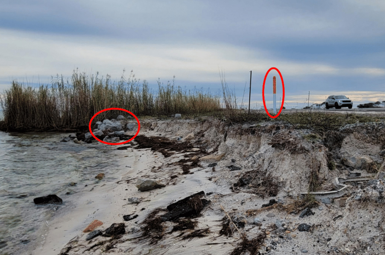
“The project will be a 4,500-foot-long living shoreline that would include a nearshore intertidal limestone breakwater,” explained Norberg. “We would then come back to the landward side and plant native vegetation, including sea oats or various types of grasses that are found in that area.
- Norberg says the idea is to help stabilize that shoreline along Okaloosa Island, and reduce a lot of the wind and wave energy that occurs, especially during the winter. “In the long run, hopefully, we will be able to see some shoreline actually recover and re-expand itself,” he noted. This project also potentially creates more than 1.5 acres of intertidal reef habitat and more than 6.2 acres of protected seagrass recruitment area.
The project has garnered support from key stakeholders, including Eglin Air Force Base, whose concern is mission readiness and the road’s importance for their operations. The Nature Conservancy, with extensive experience in creating similar living shorelines, will be a key collaborator. The Florida Department of Transportation (FDOT) has also been engaged in conversations and is supportive of the project.
The project team anticipates working alongside the community and local organizations including the Choctawhatchee Bay Estuary Program and Choctawhatchee Basin Alliance.
- “This would be the largest inshore coastal restoration project to date in Okaloosa County and highlights the value of collaborating across local, state, and federal organizations to achieve common goals,” Norberg said.
Funding for the project is being sought through various grant opportunities, with a number of applications currently being reviewed, according to Norberg. One application is for the NOAA Transformational Habitat grant, which Norberg says he should hear back on in July. He’s also looking at submitting to the National Coastal Resiliency Fund grant opportunity coming up in April.
- The county is also working with the Department of Defense’s Readiness and Environmental Protection Integration (REPI) program, which allows for off-installation related community resilience funding opportunities.
There’s several different levels of a living shoreline, Norberg explained. Essentially, it’s combining a nature-based solution to address coastal erosion. While there are several design approaches used to create living shorelines, in the situation along Highway 98 on Okaloosa Island, it would be combining a green-gray solution to maximize its potential.
- The gray part would be the limestone breakwater off into the water.
- The green component would be the planting of vegetation.
“The value of combining those two [limestone breakwater and native vegetation] is the breakwater will reduce the wind and wave energy causing the erosion and help further protect the plants that we then would install, but it also provides a ton of habitat for a variety of different species,” he said. “So from an ecosystem perspective, it’s much more beneficial as opposed to something like a regular sea wall that has little to no natural benefit or no support towards ecosystem components.”
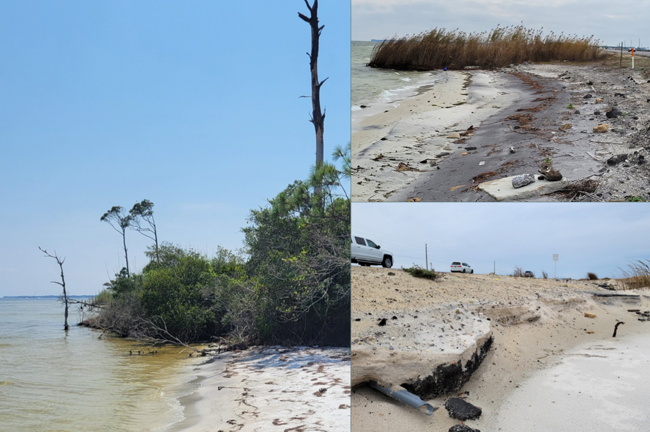
He added that one of the values of a living shoreline is that it naturally expands itself. From the plants continuing to grow and create more shoreline stabilization and accretion, or providing a foundation for oysters beginning to grow and build.
- “From a resiliency perspective, living shorelines are actually pretty resilient to nature’s impacts,” he said. “Ultimately, that also reduces maintenance costs down the road.”
For Norberg, the approval of the MOU for the living shoreline project on Okaloosa Island signifies a crucial step towards combating coastal erosion and safeguarding the vital Highway 98 corridor. And even though the project won’t happen overnight, it’s an exciting step forward.
“This has been on my wishlist for years: the visibility of having something nature-based on Okaloosa Island that also has resiliency components,” he said. “As the Coastal Resource Team adds more focus into the Choctawhatchee Bay, this is a really good opportunity to combine the experiences we have with our various coastal resource programs and implement them on a Bay project.”

