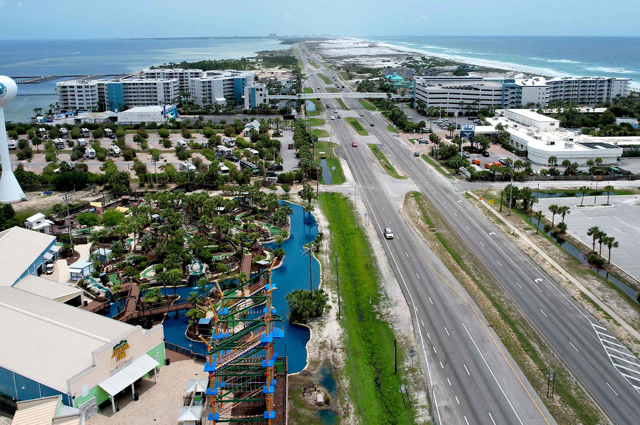
Okaloosa County officials will break ground on a new multi-use path connecting two bridges on Okaloosa Island, marking a significant step in improving safety and recreation for residents and visitors.
- The groundbreaking ceremony is scheduled for 7 a.m. on Monday, July 8, 2024, at John Beasley Park on Okaloosa Island. The path will stretch approximately four miles between the Brooks Bridge and Marler Bridge.
“The safety and well-being of our residents and visitors is a top priority and this new path will improve safety while also providing a quality recreational asset in the County,” said Okaloosa County Board Chairman Paul Mixon. “I applaud the work of the County staff and the perseverance of Commissioner Ketchel who has worked to move this project forward.”
The project includes a 12-foot wide path that will offer cyclists and pedestrians a protected route to enjoy the scenery of Destin-Fort Walton Beach. Construction plans also involve stabilizing the shoulders and parking areas along the south side of U.S. Highway 98 where the path will be built.
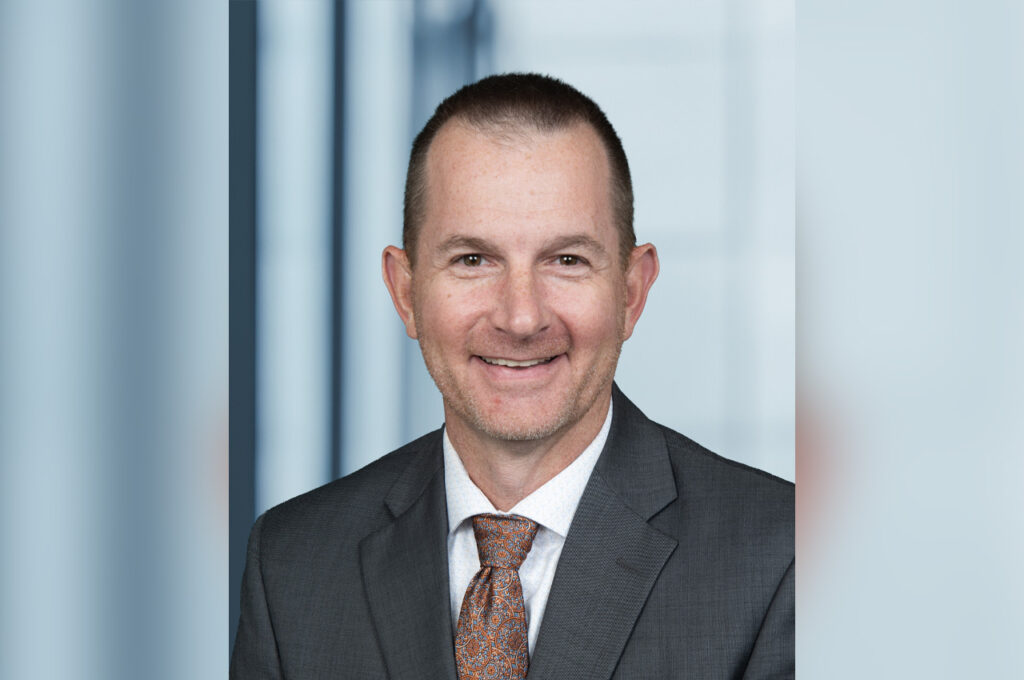
Okaloosa County District 2 Commissioner Carolyn Ketchel, who has been instrumental in moving the project forward, stated, “This path has been a vision for many people who have been looking for a safe place to walk, bike, and exercise on Okaloosa Island. We are fortunate to be able to move this project forward with input from local residents and the cooperation of our partners at Eglin Air Force Base.”
The project is a collaborative effort, with input from local residents and cooperation from Eglin Air Force Base. Funding for the construction comes from multiple sources, including tourism revenue and a grant from the Florida Department of Transportation.
Officials expect the path to be open to the public in early 2025, providing a new recreational option for the community and visitors to the area.
26 Responses
Great idea!! It’s long overdue and will be much safer for everyone on that stretch of the island.
OMG. SERIOUSLY!?! DURING the Brooks Bridge replacement project AND peak tourism season!?!?! Thanks. HUGE thanks.
The safety of cyclists and pedestrians should be given absolute priority. We should adopt the Netherlands motto. Pedestrians first, cyclists second, trains third, buses fourth and lastly automobiles. Unfortunately we do the opposite.
So true unfortunately!
It’s just the groundbreaking ceremony. Chill.
Commissioner Ketchel is a visionary, always making our community better. What a great idea.
When will something be done about that traffic going to and from Okaloosa Island to Destin? It is insane every day. The traffic starts backing up in both directions to and from Destin. That’s what we need to be working on. Adding other lanes are a bypass are another way to connect Walton to Destin
This will actually relieve traffic because some may choose to cycle this path to shop or commute. They are already doing something about the traffic by building a flyway to eliminate traffic lights into Fort Walton Beach. The path is on the south side. The traffic in the afternoon is on the north side so this project will not delay traffic flow.
Yeah! All these people who are going to bicycle 7 miles each direction in the middle of summer are sure to ease the traffic burden. I don’t think 12 feet will be wide enough for all the use this path is sure to see.
100% agree, 12 feet now will need to become 15 to 18 in 10 years…. Planning ahead is fine as long as thinking ahead is incorporated, otherwise failure is inevitable
Did you know that the state of Florida has a law that requires a 3 mile multi use path from a city on highways outside the city limits. Three miles from each city will join the path. In fact Governor Desantis already gave some of the funding for this project. Besides safety of pedestrians and cyclists is far more important than cars wait time. With e-bikes summer will be no problem. Tourist need a place also. Much of this is being paid for by donations and Tourism development.
E bikes should be RESTRICTED from using paths like that due to the numbers of walkers, joggers and regular (REAL) bicycles since e bikes are faster…. or RESTRICT E BIKES FROM USING BATTERY POWER on this path and others like it
Spoken like a true Democrat…. Go away!
The government has not yet been educated about e-bikes. It should be okay to ride your e-bike on bike paths with motors that can not go over 15 mph because bicycles can go that fast. The e-bikes owner would need to pedal to go any faster than that. This is a regulation in some other countries. There is an e-bike for sale now that can go 70 mph. I vote republican but I’m not in favor of letting high speed e-bikes share paths with cyclists and pedestrians. Lawlessness is insanity and is not a characteristic of being a republican. I’ve heard of an high speed e-bike seriously injuring a pedestrian that was hospitalized with life threatening injuries and the e-bike rider was never found. It depends on the type of e-bike. I can ride a bicycle up to 25 mph but some e-bikes can exceed that. They should be banned from paths.
When are BCC’s going to do improvements from Florosa to Wynne Haven Beach?
Numerous overgrown lots, abandon vehicles. No street drainage for Strom water.
Recent street repaving work in Wynne Haven Beach estates was very poorly done.
A new residential area is being constructed near the Okaloosa/Santa Rosa County line, adding traffic to the over capacity US 98.
Dan Mancini
Wynne Haven Beach
This is being paid for with tourism development money, private donations and a grant from Governor Desantis. What does this have to do with the highway in Mary Esther? Cyclist and pedestrians should be given priority. State law actually requires bike paths for 3 miles outside of city limits.
Hats off to Commissioner Ketchel for this much needed path to recreate and provide safe passage. Now get off your dang golf carts, hop on a bike and enjoy the great outdoors!
I am soooo excited about this. I hope I am the first person on the completed path!
Well it’s about dang time. Miss Ketchel and alot of us have been clamoring for years to get started. Way to go Caroline for your patience and endurance on this project.
I can appreciate the concern of pedestrians and cyclists on 98, but this is also causing me greater concern as this will drive a lot more vehicular traffic to access the “parking” areas crossing the exact same areas to offer said protection. Will there be amber lighting along the pathway?
What will be the accessibility of golf-carts on the same path and who is allowed to operate them? This is now an unpatrolled DUI path from the Island to Destin.
Does this lend a greater risk of parking in the military restricted areas as they will now offer a 12′ wide paved area directly in front of the areas? As of yesterday, there were still unauthorized vehicles parking in the restricted zones in the sand next to posted signs.
The usual yellow caution bumps for bikes at the parking lot entrance and cars should see cyclists as they approach the parking area just like 30A.
I totally agree. Current e-bikes that are being manufactured go too fast to be on a pedal bike path. In 2025 I am hearing that no e-bike shall be manufactured that exceeds 15.5 mph like Europes law. E bike enthusiasts are not happy but it is best for them or else they will be prohibited from riding on roads or bike paths. The federal government is also discussing a requirement for e-bikes to have insurance, license and registration to make sure they are not modified to go faster.
Are they required to have ANY Rules of the Road knowledge? I see them nightly and many have no lights nor any reflective equipment on bike. Dark clothing too. It was my understanding that ANY equipment on the road with any type of motor must follow the rules. Certainly not the teenagers. Who oversees this?
Why don’t you move to Europe. It seems everything is so great in Europe? This is the USA, STOP TRYING TO PEDAL YOUR SOCIALIST Liberal VALUES ON OTHERS. I lived overseas several years, no one has more freedom then us, stop complaining and forcing your utopia on others, will never work here bro….
Cyclist are required to have a white front light and a rear red light at night. Only children are required to wear a helmet.
I’m not at all a sociallist or liberal. I just want safety for myself and others. Ron Desantis pledged money for this. I was refrencing Europe in regards to e-bike manufacturing. It’s just a law like seatbelt laws. Does that make seatbelts socialist.