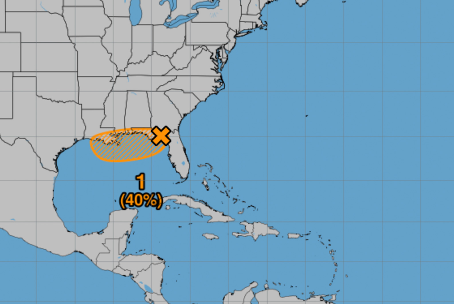
Invest 93L is moving over the Florida peninsula and producing heavy rain in that area, with a 40 percent chance of tropical development forecast mainly for when the system emerges into the Eastern Gulf Wednesday, according to Okaloosa County Public Safety Director Patrick Maddox.
- Most reliable models keep the system weaker and disorganized, though a named storm is possible if the system tracks farther south, Maddox said in a briefing Tuesday following a morning tropical analysis and coordination call with the Florida Division of Emergency Management.
Most models currently point to a Louisiana landfall for whatever system ultimately arrives there, but officials are a couple of days from that determination, Maddox said.
The environment is supportive for some strengthening as the system moves west and passes the area to the south. Expected local impacts range from elevated rain chances on the low end to 2-4 inches of rain over the next seven days with some minor coastal flooding on the high end, though Maddox said it’s too early to determine if coastal flooding is even a threat.
- “Really too early to determine if that is even a threat- but don’t want to ignore it,” Maddox said.
Elevated rip current risk and higher swells with rough surf are very likely, and periods of heavy rain are possible if banding features form. Guidance indicates a fast-moving system, which Maddox said the county has coordinated with the National Weather Service Mobile office to verify.
“We won’t really be able to dial into this in great detail until we see exactly where it emerges into the Gulf, but we will be monitoring closely,” Maddox said.
The emergency management team is in frequent contact with Okaloosa County and municipal leadership to provide updates and assess any unmet needs. Maddox advised residents to review and rehearse their plans frequently as a precaution.
“It’s always good to review/rehearse your plans frequently, just in case,” he said.