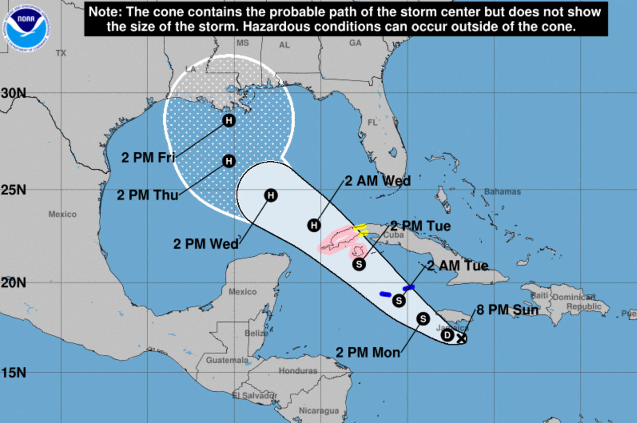
Invest 92 is now Potential Tropical Cyclone Twenty Six.
This system is forecast to quickly build the structure necessary to be classified as a Tropical Depression and reach Tropical Storm Strength within 24 hours, according to Patrick Maddox, Okaloosa County Public Safety Director.
“Although the below graphic shows hurricane strength not reached until Wednesday, if the shear decreases earlier we may see hurricane strength earlier than that, even with interaction with Cuba,” said Maddox on Sunday afternoon.
“We have a different angle of approach than Sally, but we find ourselves in a very similar condition in not knowing whether the storm will track left or right of center. Without a defined center of circulation yet, the below graphic is a “ best estimate” and error margins at the 5-day mark can be about 200 miles,” Maddox continued.
Key Messages
- Tropical storm conditions are expected in the Cayman Islands beginning late Monday, and a Tropical Storm Warning is in effect.
- Dangerous storm surge and hurricane conditions are possible in portions of western Cuba and the Isle of Youth by Tuesday afternoon, and a Hurricane Watch is in effect.
- Heavy rainfall will affect portions of Hispaniola, Jamaica, the Cayman Islands, and western Cuba during the next few days and could lead to life-threatening flash floods and mudslides.
- The system is forecast to approach the northern Gulf Coast late this week as a hurricane. While there is large uncertainty in the track and intensity forecasts at these time ranges, there is a risk of dangerous storm surge, wind, and rainfall hazards along the coast from Louisiana to the western Florida Panhandle. Residents in these areas should monitor the progress of the system and check for updates to the forecast during the week.


