The National Weather Service in Mobile has issued a Severe Thunderstorm Warning for Northwestern Okaloosa County until 230pm. At 147 PM CST, severe thunderstorms were located along a line extending from 9 miles east of I65 And AL 113 to 3 miles east of Orange Beach, moving east at 45 mph.
We are within a couple of hours of expected impact from the severe weather predicted to pass through our area.
“Now is the time to be off the roads”, said Patrick Maddox, Director of Public Safety for Okaloosa County. “Have plans in place and pay attention to weather alerts.”
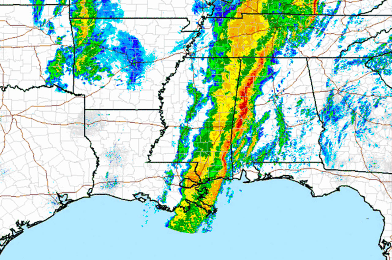
The main squall line is continuing to steadily move East and will likely be clear of our entire area by 5pm. The main threat with the line will be damaging straight line winds, although an embedded tornado is still possible.
Most of this squall line is covered in severe thunderstorm warnings. A few tornado warnings too. This will race eastward and move into the @weartv between 12 PM – 6 PM. Have your plan in place. #NWFL #flwx #alwx pic.twitter.com/8w7E5c7yEl
— Kaitlin Wright (@wxkaitlin) January 11, 2020
In addition, strong winds continue outside of the storms with numerous gusts of 35 to 45 mph being reported across the area.
“The majority of tornado warnings have been North of our latitude so far”, said Maddox. “But I suspect some discreet cells may produce some for us as well. Escambia is currently under a severe thunderstorm warning which I suspect we will see as well.”
Storm line out of @weartv area by around 6 or 7pm. pic.twitter.com/ir8ubiRE19
— Allen Strum (@WEARAllenStrum) January 11, 2020
👋 Sign-up for our free local newsletter
The BEST way to stay updated on the headlines along the Emerald Coast every single day. Never miss important local info!