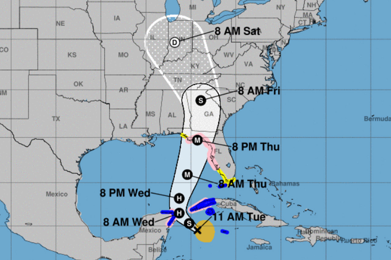
Tropical Storm Helene has formed in the northwestern Caribbean Sea, prompting hurricane and storm surge watches along the Florida Gulf Coast.
- The National Hurricane Center (NHC) issued an advisory at 2 p.m. EDT Tuesday, September 24, 2024, outlining the storm’s development and projected path.
Helene, previously known as Potential Tropical Cyclone Nine, is located about 175 miles southeast of Cozumel, Mexico, and 175 miles south of western Cuba. The storm is moving west-northwest at 12 mph with maximum sustained winds of 45 mph.
A hurricane watch is now in effect from Englewood to Indian Pass, including Tampa Bay. Storm surge watches extend from Indian Pass southward to Flamingo, encompassing Tampa Bay and Charlotte Harbor.
“Helene is expected to reach hurricane strength tomorrow morning,” said Patrick Maddox, Okaloosa County Public Safety Director. “Landfall is still expected in the Big Bend area as a 115 mph Category 3 hurricane Thursday evening.”
- Maddox added that Okaloosa County could see tropical storm force winds as early as Thursday mid-day to afternoon. On the current forecast track, sustained winds in the area would generally be below 20 mph with gusts to 35 mph.
The NHC warns of potentially life-threatening storm surge, with water levels possibly reaching 10-15 feet above ground from the Ochlockonee River to Chassahowitzka, Florida.
Rainfall totals of 4 to 8 inches are expected across the Southeastern U.S., with isolated amounts up to 12 inches, raising the risk of considerable flash and urban flooding.
“Marine and surf impacts are expected to be 8-10 foot high surf and high waves off-shore as well as dangerous rip currents Wednesday through Saturday morning,” Maddox said. He also warned of the potential for tropical tornadoes, particularly east of Gulf County through the peninsula.
Officials stress that the forecast can change and urge residents to stay informed and prepared as Helene approaches.