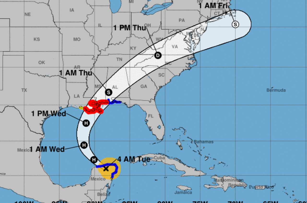
Zeta has temporarily weakened to a tropical storm but should regain strength and become a hurricane again later today.
According to Okaloosa County Public Safety, Zeta should begin to curve to the north by tonight and eventually northeast on Wednesday ahead of a strong upper level low approaching from the west.
Zeta is forecast to make landfall along the coast between southeast Louisiana and coastal Mississippi Wednesday evening and then lift northeast across our area Wednesday night into Thursday morning.
According to Patrick Maddox, Okaloosa County Public Safety Director, Zeta is likely to make landfall as a hurricane and gradually weaken as it moves inland.
“Zeta is likely to be a strong tropical storm as it moves into our area, but there still remains some possibility that Zeta remains a hurricane while moving across far southeast Mississippi into coastal sections of south Alabama,” said Maddox on Tuesday morning.
Zeta will likely bring damaging winds, heavy rains, high surf and rip currents, storm surge, and isolated tornadoes.
“The threat for local impacts continues to increase, especially with regard to wind impacts,” said Maddox. “Scattered-to-numerous downed trees and power lines are expected along with scattered to numerous power outages.”

