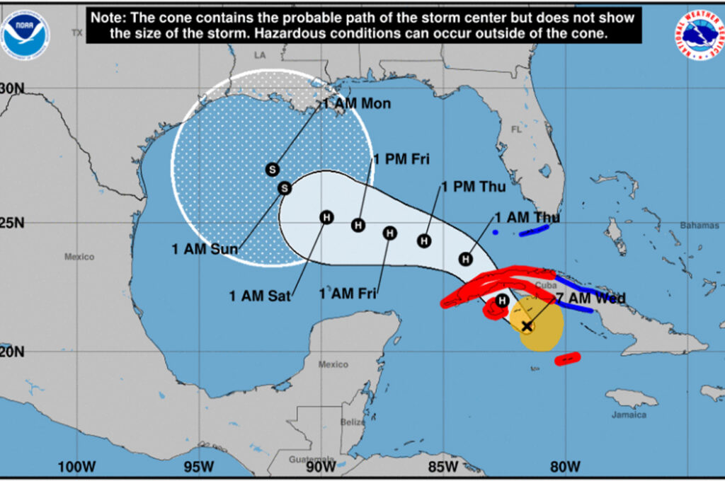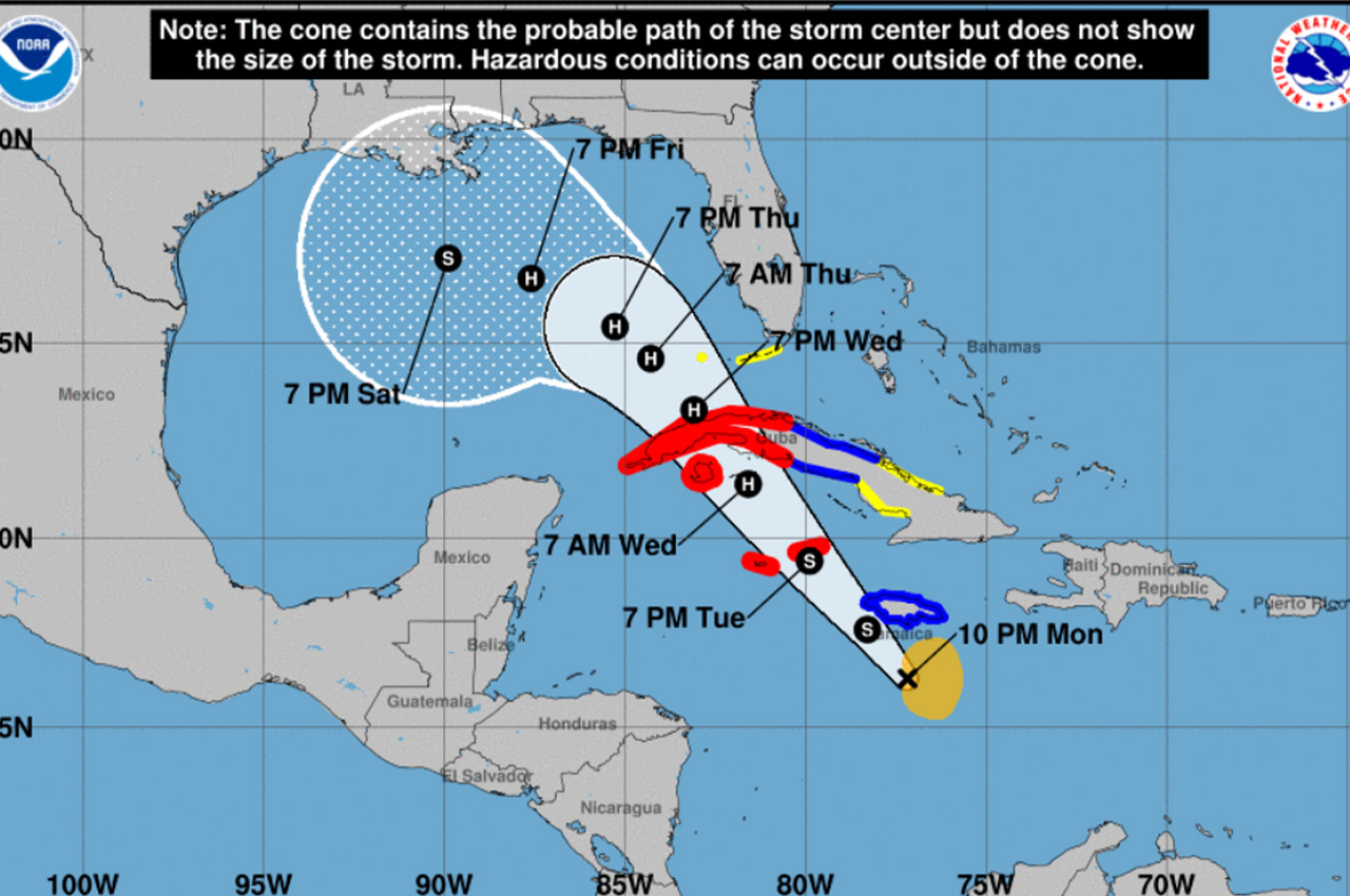
While Okaloosa County currently sits just outside the projected path of Tropical Storm Rafael, emergency management officials are closely monitoring the system as it moves toward the Gulf of Mexico.
- Okaloosa Public Safety Director Patrick Maddox reported Monday night that despite some dry air entrainment limiting recent development, the storm’s outer core is showing signs of organization with further strengthening in the forecast.
“There is still significant spread in model guidance, and with that, lack of confidence in local impacts at this point,” Maddox said. “We hope for some clarity as models come into better alignment in the coming model runs.”
According to the National Hurricane Center’s 4 a.m. Tuesday advisory, Rafael is becoming better organized with more prominent convective banding features, particularly in the eastern portion of the circulation. An Air Force Hurricane Hunter aircraft recorded falling central pressure with maximum winds approaching 50 knots.
The system is moving northwestward at 11 knots and is expected to maintain this general direction for the next couple of days, crossing western Cuba and entering the southeastern Gulf of Mexico. However, forecasters note lower-than-usual confidence in the 4-5 day forecast due to disagreement between key weather models.
- While the European model (ECMWF) suggests a stronger mid-level ridge over the southeastern U.S. could push Rafael into the western Gulf, the American model (GFS) indicates this ridge may break down in 3-4 days, potentially allowing for a northward turn.
The NHC warns it is too early to determine what, if any, impacts Rafael could bring to portions of the northern Gulf Coast, advising residents to regularly monitor forecast updates. Heavy rainfall is expected to spread north into Florida and adjacent areas of the Southeast United States by mid to late week.