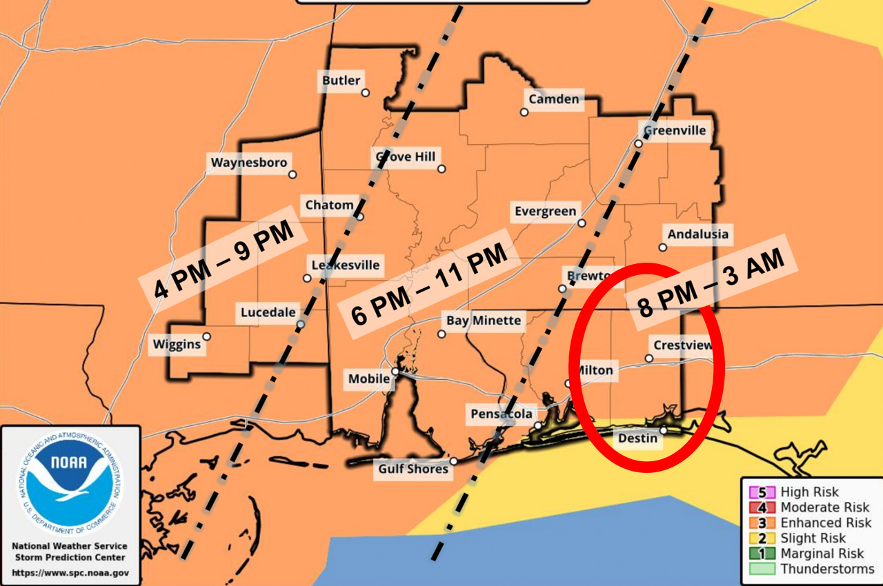
Okaloosa County emergency officials have upgraded the severe weather threat, placing the entire county under an “Enhanced” risk category as dangerous storms approach the area.
- In an afternoon update, Okaloosa Public Safety Director Patrick Maddox reported that the enhanced risk area now extends beyond Okaloosa to include areas east and west of the county.
“The main risk for this system continues to be damaging straight-line winds in excess of 60 mph within the thunderstorms, hail and tornadoes, some of which can be EF2 or stronger in the enhanced risk area as the line of storms moves through,” Maddox said.
Non-thunderstorm “gradient” wind gusts up to 40 mph have already begun and will continue until the system passes through the region.
The timing for storm impacts remains between 8 p.m. Tuesday and 3 a.m. Wednesday, with Okaloosa County expected to be affected in the later portion of that window. Despite the severe threat, rainfall is still predicted to remain under 1.5 inches due to the system’s fast movement, though brief downpours are possible.
- Maddox warned that any discrete cells forming ahead of the main squall line, described as a Quasi-Linear Convective System (QLCS), would have tornadic potential. Additional hazards include dangerous rip currents and surf building to 7-11 feet. A gale warning takes effect at 3 p.m. Tuesday.
Weather officials are currently analyzing two possible scenarios for the storm system.
The first, which is now being favored by the National Weather Service, involves enough energy to overcome cloud cover, resulting in higher confidence for damaging straight-line winds and tornadoes.
- The second scenario would see warm air aloft preventing tornadic development and reducing the wind threat as the system moves eastward.
“Please have multiple ways to receive emergency information and remain weather-aware,” Maddox urged residents.
County officials continue to monitor the developing weather situation.