Okaloosa County Public Safety Director Patrick Maddox said Sunday that a developing weather system is forecast to bring 1 to 2.5 inches of rain to the area over the next seven days, with no significant flooding currently expected.
- The system, associated with the remnants of a more-organized disturbance, has a brief window to reorganize as it moves off the Mexican coast toward warm water near the Texas coastline, Maddox said.
Models are varied on how much time the system may spend over water, and chances of significant strengthening are low. That window closes quickly as another low-pressure system approaches from the west.
Rainfall is expected to arrive in two windows, according to Maddox. From Monday through Wednesday, the area should see 0.25 inches at the coast to 0.75 inches at the north end of the county. From Wednesday through Friday, totals are forecast at 0.75 inches at the coast and up to 1.75 inches at the north end.
Some rain could be heavy at times, Maddox said, though he described the totals as within typical ranges for the area. Heavier pockets of precipitation, up to 5 inches, are forecast to fall north of Okaloosa County, and officials will monitor local river gauges as the north-to-south flow ramps up. Aside from gusty winds in stronger thunderstorms, no organized tropical wind field is forecast.
Marine conditions are expected to be less forgiving. With the Emerald Coast Blue Marlin Classic fishing tournament set to begin midweek, Maddox said mariners should pay close attention to conditions and Coast Guard advisories. Winds above 20 knots and offshore wave heights of 5 to 7 feet are possible, and Small Craft Warnings are likely.
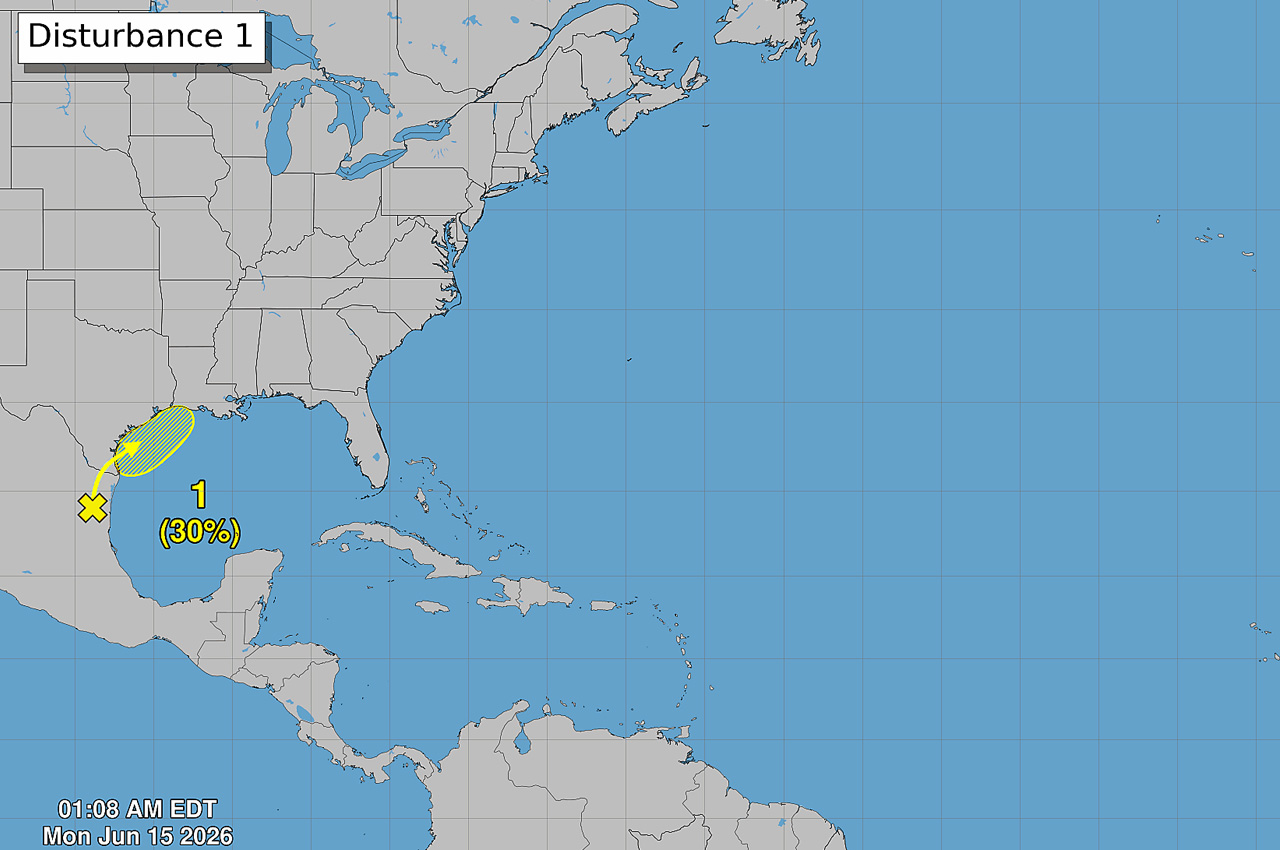
The National Hurricane Center said in its latest discussion that a trough of low pressure located over northeastern Mexico is producing disorganized shower and thunderstorm activity. Development is not expected during the next day or so while the trough remains inland and drifts northward over northeastern Mexico or southern Texas.
- The system is then forecast to move northeastward and could re-emerge over the northwestern Gulf late Tuesday or Wednesday, where environmental conditions may support some development around midweek.
The NHC put the formation chance at near 0% through 48 hours and 30% through seven days. Regardless of formation, heavy rainfall and flash flooding are possible across portions of eastern and southern Texas and Louisiana this week, the agency said.
“Keep your umbrellas handy, and go about your daily routines while remaining weather-aware,” Maddox said. “We’ll let you know if there’s something to get perked up about.”