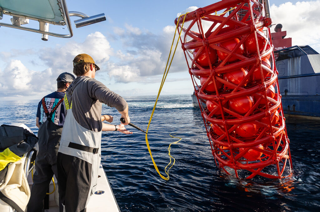
The tourism department of Okaloosa County deployed the first four Fish Aggregating Device (FAD) buoys on August 11, 2020. The deployment took place at four locations found 60-80 miles off the Destin-Fort Walton Beach shore and is the first FAD buoy deployment in the continental United States.
And Get The Coast was along for the deployment!
The deployed buoys were manufactured in Japan, where FADs are widely used. According to County staff, the technology used within these FADs has been fine-tuned for best results.
The approximately 15-foot-tall buoys are attached to a ~32,000lb concrete anchor to prevent shifting from their deployment location. The majority of the structure exists below the waterline, providing habitat or structure for smaller fish species which become food for larger highly sought-after species of pelagic fish like tuna, marlin, and mahi mahi.
The deployment was successfully conducted by Walter Marine from Orange Beach, AL and funded by Destin- Fort Walton Beach.
“The deployment went extremely smooth and there were already fish associating with the buoys shortly after deployment. We even had a white marlin show up while we were deploying the buoys so we must be placing these in good locations. Hopefully, we will see and hear about local and visiting anglers using these sites, especially during the Destin Fishing Rodeo in October,” said Alex Fogg, Coastal Resource Manager at Destin- Fort Walton Beach.

Over the next few months, the FAD buoys will be monitored to ensure they are enduring and performing well. The remaining four buoys (with weather stations) will be deployed in the coming months.
FAD Buoy Number Latitude Longitude Charted Depth
| FAD Buoy Number | Latitude | Longitude | Charted Depth (ft) |
|---|---|---|---|
| 2 | 29° 27.342 | -87° 07.036 | 1,610 |
| 3 | 29° 23.353 | -87° 11.166 | 1,822 |
| 6 | 29° 20.887 | -86° 52.748 | 1,715 |
| 7 | 29° 14.914 | -86° 52.815 | 1,830 |