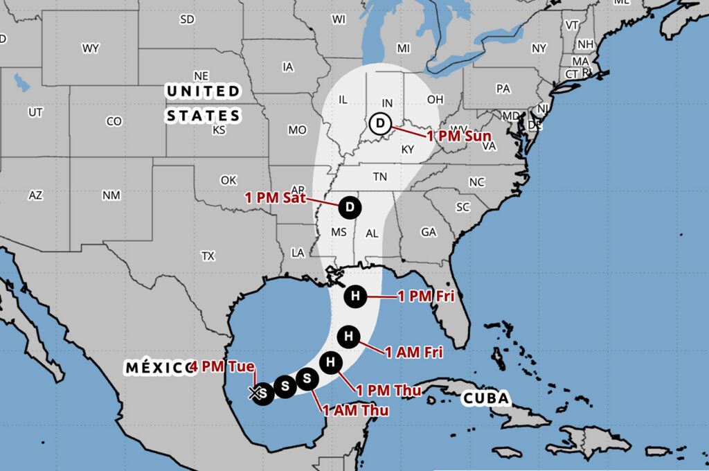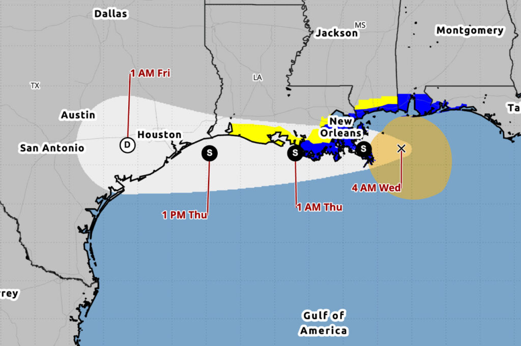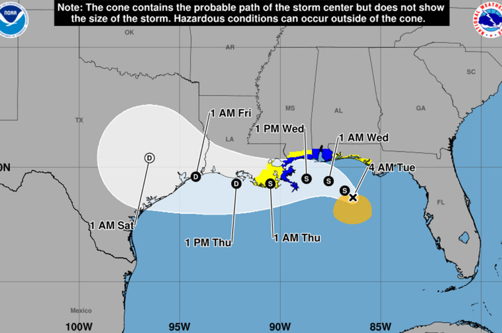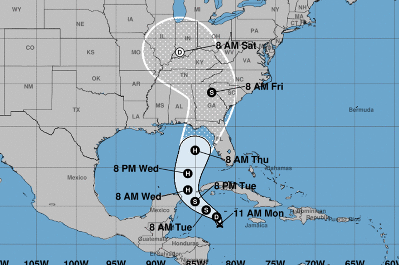
The National Hurricane Center issued its first advisory Monday for Potential Tropical Cyclone Nine, located about 130 miles southwest of Grand Cayman. The system is expected to intensify as it travels northward across the Caribbean and into the Gulf of Mexico.
- Forecasters predict the cyclone will reach hurricane strength by Wednesday and could become a major hurricane before reaching the northeastern Gulf Coast on Thursday.
“There is an increasing risk of life-threatening storm surge and damaging hurricane-force winds along portions of the northern and northeastern Gulf Coast, including the Florida Panhandle and portions of the Florida west coast,” the hurricane center warned in their public advisory.
As of 11 a.m. EDT Monday, the disturbance had maximum sustained winds of 30 mph. It was moving north at 6 mph, with a shift to a northwestward motion expected Tuesday.
Tropical storm warnings have been issued for parts of Mexico’s Yucatan Peninsula and western Cuba, including the Isle of Youth. Hurricane watches are in effect for portions of Mexico’s east coast and Cuba’s Pinar del Rio province.
The system is forecast to bring heavy rainfall to the western Caribbean, with 4 to 8 inches expected over western Cuba and the Cayman Islands. Isolated areas could see up to 12 inches, creating a risk of flash flooding and mudslides.
- Storm surge could raise water levels by 2 to 4 feet above normal tide levels in parts of western Cuba and along Mexico’s eastern Yucatan Peninsula coast.
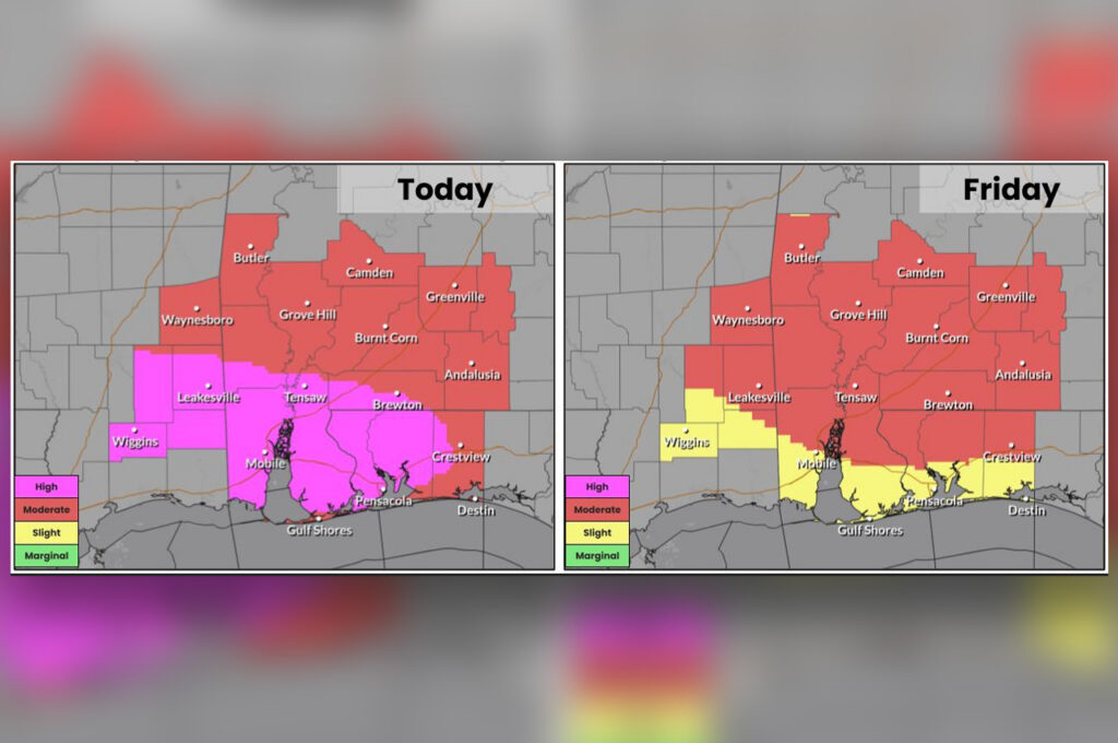
As the cyclone moves northward, heavy rainfall is expected to spread into the southeastern United States starting Wednesday, bringing a risk of flash and river flooding, according to NHC.
The National Hurricane Center urged residents in potentially affected areas to monitor forecast updates and ensure they have hurricane plans in place. While the exact location and magnitude of impacts remain uncertain, officials emphasized the importance of preparedness given the system’s potential for rapid intensification.