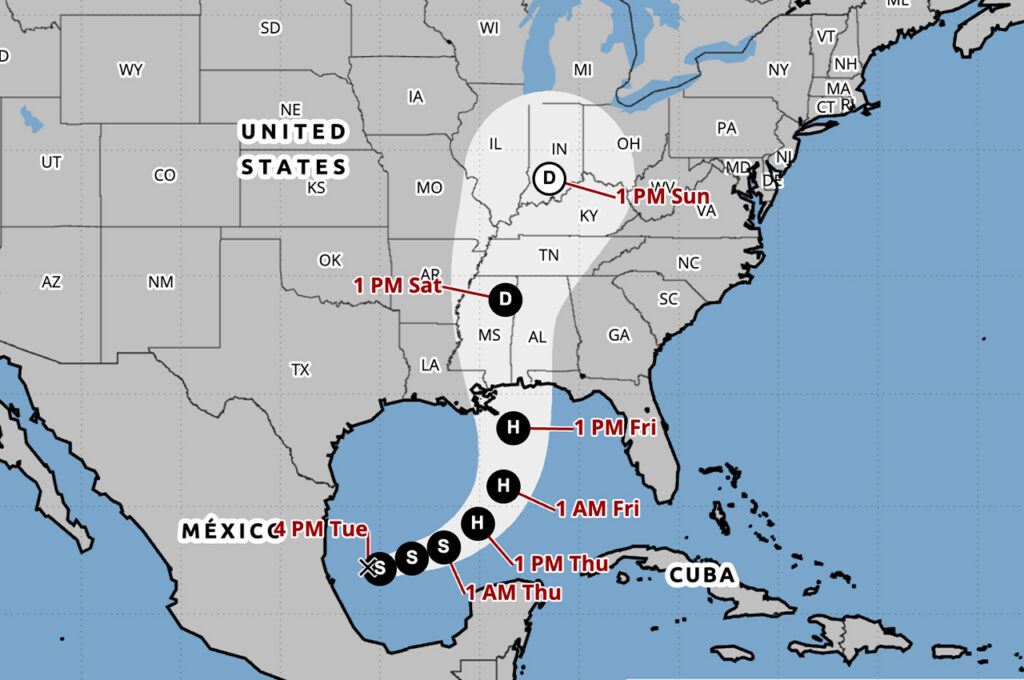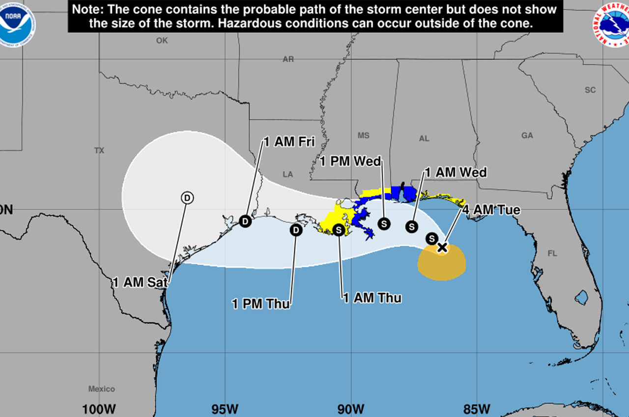
Tropical Storm Bertha continued to slowly drift through the northern Gulf early Tuesday with maximum sustained winds of 50 mph, according to the National Hurricane Center.
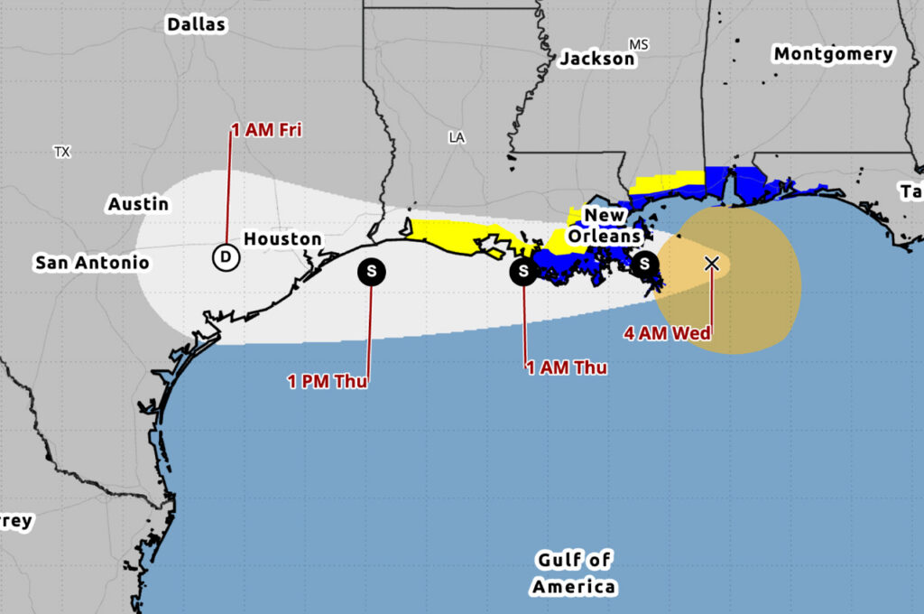
- The storm was located about 110 miles south-southwest of Panama City and about 170 miles southeast of Mobile, Alabama, as of 4 a.m. CDT. Bertha is moving northwest at 5 mph and is expected to turn westward by the middle of the week. On that forecast track, the storm will move near or along the northern Gulf Coast over the next several days.
Some slight strengthening is possible later Tuesday before the storm encounters increasingly strong northerly wind shear, which is expected to cause gradual weakening through the middle of the week, according to the National Weather Service in Mobile.
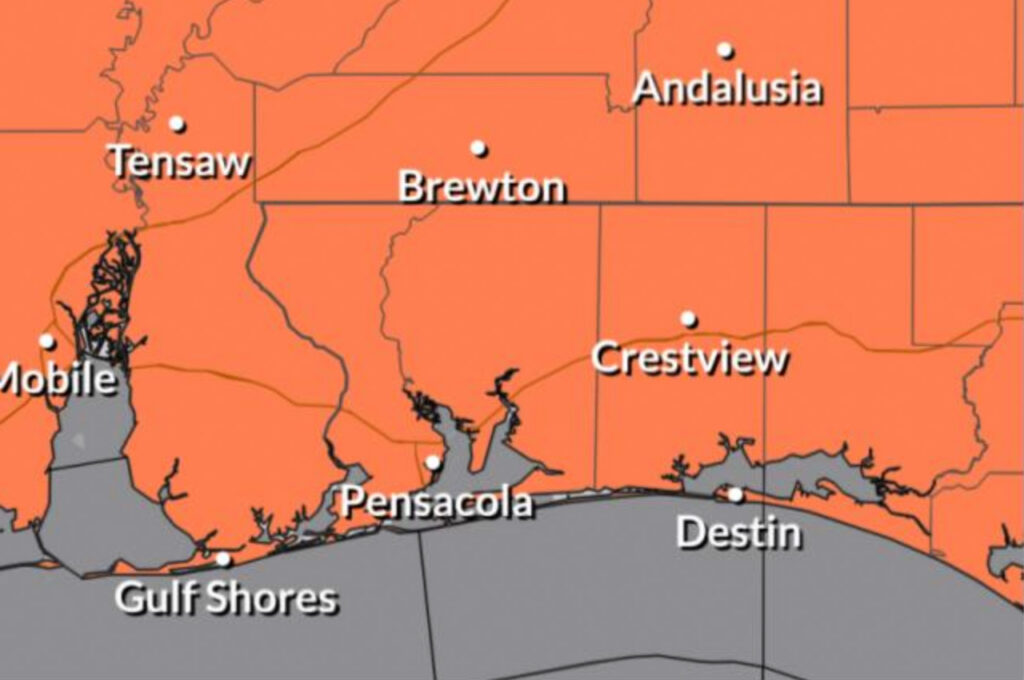
A Tropical Storm Warning is in effect from the Alabama-Florida border to the Jefferson-Plaquemines Parish border in Louisiana. A Tropical Storm Watch remains in effect from the Bay-Gulf County line in Florida westward to the Alabama border, covering coastal portions of Northwest Florida. A Storm Surge Watch is in effect for the Alabama coastline, including southern Mobile Bay.
The National Weather Service office in Mobile said potential impacts from Bertha will generally be confined to the coastal counties. The greatest concerns include coastal flooding, high surf and life-threatening rip currents.
A High Surf Warning is in effect, with breakers of 8 to 11 feet expected Tuesday afternoon through Wednesday night. Peak surf heights are forecast tonight through Wednesday morning. A high risk of life-threatening rip currents will continue through Thursday night for coastal Alabama and Northwest Florida beaches, and minor beach erosion is possible Wednesday and Thursday.
Storm surge inundation could begin as early as late tonight and peak during high tide Wednesday morning. Water could reach 2 to 4 feet from the mouth of the Mississippi River to the Alabama-Florida border and in southern Mobile Bay. Storm surge of 1 to 2 feet is possible from the Alabama-Florida border to Destin.
Tropical storm force winds of 39 to 57 mph are possible across coastal portions of Northwest Florida and Alabama. The most likely time of arrival for tropical storm force winds in Northwest Florida is this evening, according to the weather service. Wind speed probabilities have trended slightly downward, with roughly a 10% chance of tropical storm force winds in coastal Escambia and Santa Rosa counties and less than 10% farther inland.
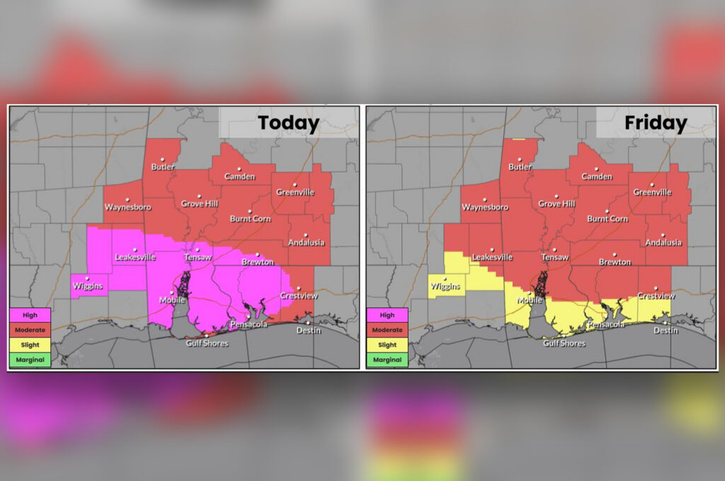
Storm total rainfall of 1 to 3 inches is possible, mainly across coastal communities, with locally higher amounts where rainbands repeatedly move over the same locations. Localized flooding is possible, particularly at underpasses, low-lying spots and poor drainage areas.
The next complete advisory from the National Hurricane Center is expected at 10 a.m. CDT.