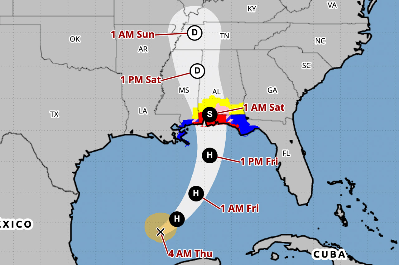
Hurricane Isaias, the first hurricane of the 2026 Atlantic hurricane season, continues to intensify in the Gulf and is expected to make landfall along the U.S. northern Gulf Coast late Friday or early Saturday, according to the National Hurricane Center’s 4 a.m. Thursday advisory.
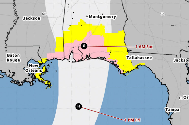
- Okaloosa County is under a Hurricane Warning. A Storm Surge Warning also remains in effect for a stretch of coast that includes the county.
“Preparations to protect life and property from storm surge and damaging winds along the warning area of the Gulf Coast should be rushed to completion today,” the National Hurricane Center wrote.
Maximum sustained winds have increased to near 80 mph with higher gusts, according to the advisory. Additional strengthening is expected through early Friday.
“Isaias should remain a strong hurricane as it approaches the northern Gulf Coast on Friday night,” the advisory states.
Watches and warnings
There were no changes to watches and warnings with the 4 a.m. advisory. The following are in effect:
- Hurricane Warning: Ocean Springs, Mississippi, to the Bay/Gulf County line in Florida
- Storm Surge Warning: Mouth of the Mississippi River to the Steinhatchee River in Florida
- Tropical Storm Warning: Jefferson/Plaquemines Parish line in Louisiana to west of Ocean Springs, Mississippi, and east of the Bay/Gulf County line to the Aucilla River in Florida
- Storm Surge Watch: Steinhatchee River to Yankeetown, Florida
A Storm Surge Warning means there is a danger of life-threatening inundation from rising water moving inland from the coastline during the next 36 hours, according to the National Hurricane Center.
“This is a life-threatening situation,” the advisory states. “Promptly follow evacuation and other instructions from local officials.”
Storm surge
The water could reach 5 to 7 feet above ground from Ocean Springs, Mississippi, to Indian Pass, Florida, if the peak surge occurs at the time of high tide, according to the advisory.
The deepest water will occur along the immediate coast near and to the east of the landfall location, where the surge will be accompanied by large and dangerous waves.
Wind
Hurricane conditions are expected within the Hurricane Warning area Friday night into early Saturday, with tropical storm conditions beginning on Friday.
Hurricane-force winds extend outward up to 15 miles from the center of Isaias, and tropical-storm-force winds extend outward up to 90 miles.
Rainfall
From Friday through the weekend, Isaias is expected to produce rainfall amounts of 3 to 7 inches, with localized totals up to 10 inches, across the central U.S. Gulf Coast from far southeastern Louisiana to the Florida Panhandle.
Flash and urban flooding, along with isolated river flooding, will be possible, according to the advisory.
Tornadoes
Isolated tornadoes will be possible Friday night in coastal areas of Alabama and the Florida Panhandle and far southwestern Georgia, according to the National Hurricane Center.
Surf and rip currents
Swells are expected to spread northward toward the Gulf Coast on Friday.
“These swells are likely to cause life-threatening surf and rip current conditions,” the advisory states.
Where the storm is now
As of 4 a.m. Thursday, the eye of Isaias was located by NOAA Hurricane Hunter aircraft about 420 miles south-southwest of the mouth of the Mississippi River and about 170 miles northwest of Progreso, Mexico.
Isaias is moving toward the east-northeast near 9 mph. A turn toward the northeast is expected later Thursday, followed by a turn northward on Friday.
Local evacuations and shelters
Okaloosa County’s mandatory evacuation for residents in coastal Zones A and B becomes active at noon Thursday, according to the county. Two shelters will open at 6 p.m. Thursday at Davidson Middle School in Crestview and the Raider Arena at Northwest Florida State College in Niceville.
The next intermediate advisory from the National Hurricane Center is scheduled for 7 a.m. Thursday, with the next complete advisory at 10 a.m.
Okaloosa County declares state of emergency, orders mandatory evacuation of Zones A and B ahead of Isaias
Okaloosa County declared a local state of emergency Wednesday and ordered a mandatory evacuation of Zones A and B beginning noon Thursday ahead of Isaias.